 Asset Publisher
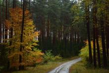
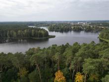
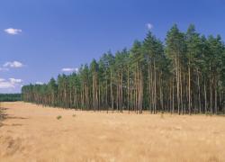
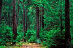
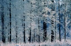
Polish forests
 fot. Paweł Fabijański
 fot. Paweł Fabijański
 fot. Paweł Fabijański
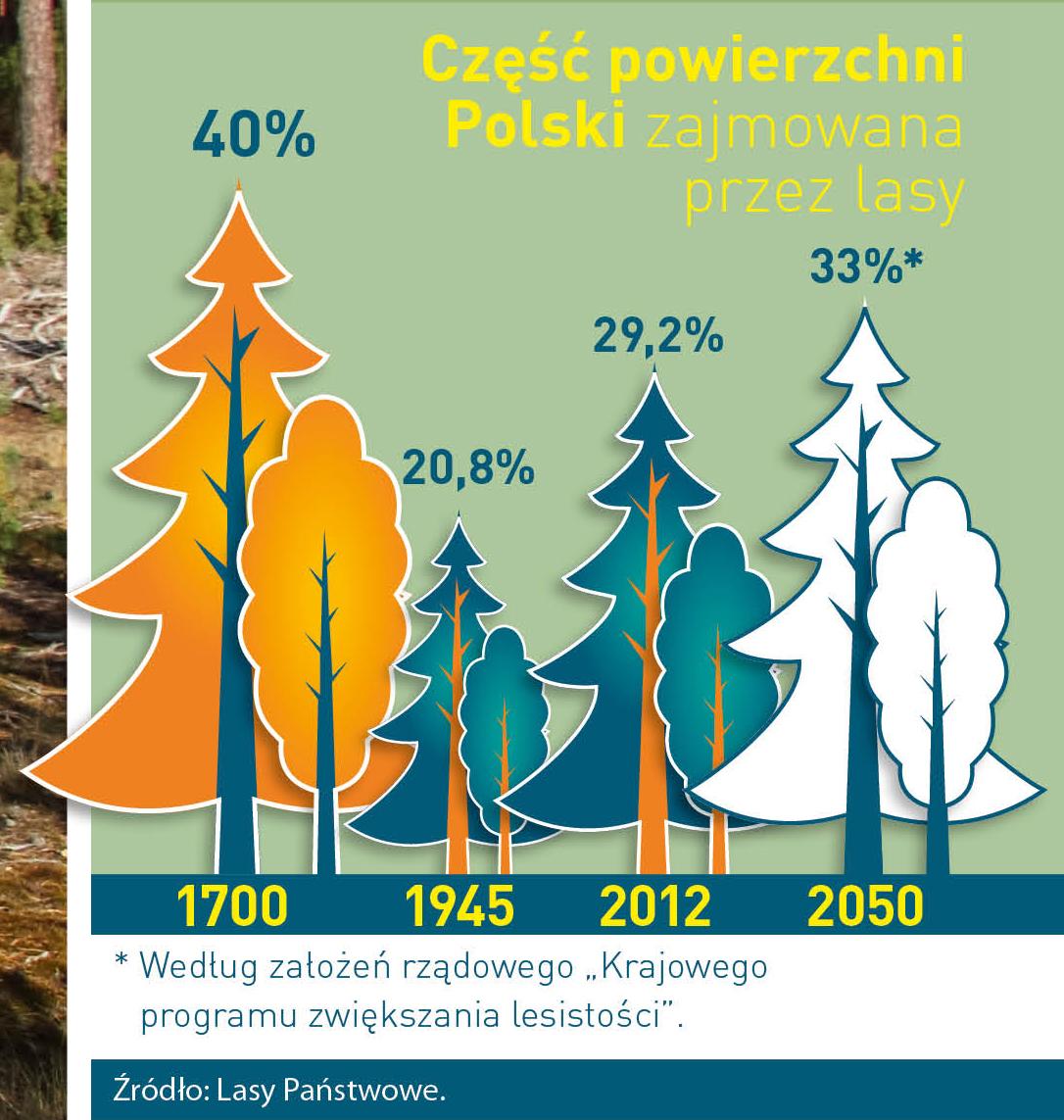
Poland is in the European lead, while concerning the area of all forests. They cover about 29,2 % of the country territory, and grow within the area of 9,1 million hectares. The overwhelming majority of the forests is state owned, of which almost 7,6 million hectares are managed by the State Forests National Forest Holding..
The number of Polish forest is still growing. The forestation rate of the country has increased from 21 % in 1945 to 29,2 % at the moment. Between 1995 and 2008, the forest area increased by 310 thousand ha. The basis for afforestation works is the "National Programme for Increasing the Forest Cover" (KPZL), assuming an increase of the forestation rate up to 30 % by 2020 and up to 33 % by 2050. Polish forests abound in flora, fauna and fungi. 65 % of the total number of animal species live there.
The forests grow in our country on poor soils, mainly because of the development of the agriculture in previous years. It influences the distribution of the types of the forest sites in Poland. Over 55 % of the forest areas is covered with coniferous forests. In other areas, there are forest sites, mainly the mixed ones. Their small part constitute alder and riparian forests – not more than 3 %.
In the years 1945 – 2011 the area of natural deciduous tree stands within the area of the State Forests National Forest Holding increased from 13 to 28,2 %.
Within the lowlands and uplands the most often occurring tee species is pine. It covers 64,3 % of the forest area of the State Forests National Forest Holding and 57,7 % of private and commune forests. In the mountains the predominant species is European spruce ( in the west) and European spruce with beech (in the east). Domination of pine is the result of carrying on sustainable forest management in the past. Once, the monocultures (crops or cultivations of one species) were the answer to the great demand of industry for wood. Such forests appeared to be quite fragile to climatic factors. They also were often the prey of pests' expansion.
In Polish forests, the share of other tree species, especially deciduous trees have been systematically increasing. The foresters have stepped aside from monocultures – that is why, they try to fit specific species of the forest stand to the natural stand, that would be proper for the given area. Thanks to that, in the years 1945 – 2011, the area of the deciduous tree stands within the lands of the State Forests National Forest Holding increased from 13 to 28,2 %. There occur more and more frequently the following tree species: oaks, ashes, maples, sycamore maples, elms, but also birches, beeches, alders, poplars, hornbeams, aspens, tilias and willows.
Our forests are the most often represented by the forest stands aged 40 to 80 years. The average age of the forest equals 60 years. More and more trees are of big size at the age over 80 years. Since the end of the Second World War, the forests' area has increased up to almost 1,85 million hectares.
Raport o stanie lasów w Polsce 2012
Asset Publisher
Pomiary powierzchni leśnych
Pomiary powierzchni leśnych

 pomiar powierzchni zrębu w Leśnictwie Stronno
Podsumowanie działalności grupy związanej ze stworzeniem
wytycznych przy pomiarach powierzchni zrębowych
Jak istotny jest komfort pracy, przy której manipuluje się powierzchnią i której efekty mogą być weryfikowane przez przełożonych, nie trzeba raczej nikomu tłumaczyć.
Jedną z takich prac jest zakładanie rębni, czy to zupełnych czy złożonych, gdzie pomiar powierzchni będzie mieć wielki wpływ na dalszy ciąg zdarzeń odbywających się na danej powierzchni (rozliczanie wypłat związanych np. z przygotowaniem gleby, odnowieniami, pielęgnacją itp.). By zapewnić sobie wyżej wymienioną wygodę przy pomiarach powierzchni rębnych należałoby pracować z urządzeniem, którego wynik obarczony byłby jak najmniejszym błędem (wynikający ze zmian położenia pomiarowego oraz rzeźbą terenu).
W tym celu w naszym Nadleśnictwie "powołana do życia" została grupa robocza, która wypracowałaby schemat i wytyczne kontroli powierzchni zrębowych (zarówno na etapie przygotowywania szacunków brakarskich jak i po wykonaniu danej rębni).
Grupa podjęła następujące czynności:
- spotkania we własnym gronie celem wymiany poglądów i doświadczeń, tzw. "burze mózgów:)",
- zorientowanie się w sprzętach oraz technologiach dostępnych na rynku,
- spotkanie z przedstawicielem firmy zewnętrznej celem odbycia szkolenia ze współdziałania aplikacji na smartfona z Leśną Mapą Numeryczną,
- spotkanie z przedstawicielem firmy zewnętrznej w celu skontrolowania działania zaproponowanych urządzeń w terenie,
- wybór urządzenia,
- stworzenie wytycznych kontroli powierzchni zrębowych.
Dzięki możliwości zastosowania urządzenia z odbiornikiem GPS, z możliwie jak największą dokładnością oraz przy prawidłowym jego użyciu, nadarza się sposobność do ułatwienia sobie pracy związanej z wytyczaniem zrębów, a także do skonfrontowania ich powierzchni rzeczywistych z powierzchniami operatowymi. Oprócz wyżej wymienionych pomiarów przy zakładaniu zrębów, gniazd, luk lub kęp ekologicznych urządzeniez odbiornikiem GPS (poprzez określenie współrzędnych x, y, z) może być użyte przy ustalaniu, kontroli i odtwarzaniu granic administracyjnych, lini oddziałowych lub wydzieleń, wyznaczaniu powierzchni i lokalizacja odnowień naturalnych i sztucznych, określanie położenia drzew i drzewostanów nasiennych, lokalizację pożarów, wskazywanie lokalizacji pól zabiegowych (np. opryski lotnicze), inwentaryzacji przyrodniczej (lokalizacja zagrożonych siedlisk i gatunków roślin, grzybów i zwierząt, lokalizacja pomników przyrody) i inwentaryzacji uszkodzeń upraw i młodników przez zwierzynę, wyznaczaniu ścieżek leśnych i edukacyjnych, tras szlaków turystycznych, a także poprzez specjalne oprogramowanie wykorzystujące Leśną Mapę Numeryczną i bazę SILP wspomaga prowadzenie bieżące zadania gospodarcze (wyświetlanie opisu taksacyjnego, plany itp.).